Enhance Your Wilderness Navigation Skills Without GPS: A Comprehensive Guide for Outdoor Enthusiasts
Becoming proficient in wilderness navigation without the aid of modern technology may appear overwhelming at the outset. Yet, acquiring fundamental map and compass navigation skills is an invaluable asset that significantly enriches your outdoor experiences. At its essence, effective navigation demands a thorough understanding of your surroundings and the ability to accurately determine your position concerning your intended destination. A map acts as a comprehensive two-dimensional representation of the landscape, while a compass offers a reliable means of orienting yourself based on cardinal directions: north, south, east, and west. By mastering these essential tools, you can confidently venture into the wilderness, independent of technological reliance.
To kickstart your navigation journey, it’s crucial to familiarize yourself with the various symbols and scales illustrated on a map; these elements are vital for accurately interpreting the physical landscape. Learning to read contour lines, which indicate changes in elevation, is particularly important as it allows you to recognize hills, valleys, and other geographical features that may impact your route. Additionally, gaining proficiency in compass usage is equally vital, as it enables you to navigate effectively in the wilderness, free from dependence on GPS devices.
The compass needle consistently points toward magnetic north, allowing you to align your map with the actual terrain. To achieve this, hold the compass flat in your hand and rotate the map until the magnetic north on the compass aligns with the north indicated on the map. This essential process, known as “orienting the map,” is fundamental for maintaining accuracy in your navigation efforts and ensuring you remain on the correct path throughout your journey.
Once your map is correctly oriented, you can use the compass to take bearings that will guide your intended course of travel. By effectively combining these two powerful navigational tools—the map and the compass—you will confidently traverse unfamiliar landscapes, ensuring you stay on track even when modern technological aids are unavailable.
Essential Principles for Successful Wilderness Navigation
- Mastering map and compass navigation is crucial for anyone engaging in wilderness exploration or outdoor activities.
- Topographic maps provide intricate insights into the terrain, elevation, and natural features, which are essential for successful navigation.
- A compass not only establishes direction but also aids effective navigation by aligning with the map’s orientation and understanding magnetic north.
- Natural landmarks and cues, such as unique rock formations or distinctive tree patterns, can serve as practical navigational aids when a map or compass is not available.
- Estimating distance and travel time is vital for planning and executing a successful navigation strategy in the wilderness.
 Discover the Vital Role of Topographic Maps in Wilderness Navigation
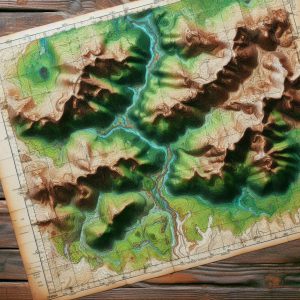
Topographic maps are essential resources for anyone planning to explore the wilderness. They deliver a wealth of information regarding the physical features of the terrain, employing contour lines to illustrate changes in elevation. This visualization allows you to understand the shape and steepness of the landscape, equipping you to prepare for the challenges that may arise. Each contour line connects points of equal elevation, and the spacing between these lines indicates whether the slope is steep or gradual, giving you the knowledge necessary for effective navigation.
Decoding Contour Lines and Map Symbols for Better Navigation
As you delve into a topographic map, it is imperative to closely observe the patterns created by contour lines; tightly spaced lines indicate steep terrain, while wider spaces denote flatter areas. This understanding empowers you to anticipate potential obstacles along your route, enabling informed navigation decisions. Moreover, topographic maps are replete with symbols representing various landmarks, including rivers, roads, trails, and types of vegetation. Familiarizing yourself with these symbols is fundamental for successful navigation, ensuring you can effectively utilize the map.
Developing Proficiency in Navigation Techniques Using Topographic Maps
For example, blue lines typically signify the presence of water bodies, such as streams or lakes, while green areas may indicate forests or dense vegetation. By cross-referencing these symbols with your surroundings, you can confirm your location and adjust your route accordingly. Additionally, topographic maps often include grid lines that assist you in pinpointing coordinates, allowing for even more precise navigation. By mastering the intricacies of topographic maps, you will deepen your appreciation for the landscape and enhance your overall navigational skills in the wild.
 Become Proficient in Directional Navigation Techniques with a Compass
An indispensable tool for any adventurer, a compass is essential for directional navigation, particularly when traversing unfamiliar terrains. To use a compass effectively, start by holding it level in front of you and allowing the needle to stabilize. The needle will point toward magnetic north, which may differ slightly from true north due to magnetic declination—the angle between magnetic north and true north varies based on your geographical location.
Before embarking on your journey, it is crucial to determine the local declination and adjust your compass accordingly. This adjustment is vital to ensure that your bearings remain accurate, aiding you in staying on course throughout your adventure. Once your compass is calibrated for declination, you can proceed to take a bearing that will guide your travel direction.
To take a bearing, identify a landmark you wish to navigate toward, and rotate the compass housing until the orienting arrow aligns with the magnetic needle. The degree reading on the compass dial that aligns with the index line indicates your bearing. As you advance toward your destination, periodically check your bearing to verify that you remain on track.
If you notice yourself veering off course, reorient your compass and adjust your path as necessary. By mastering these techniques, you will gain the confidence to rely on a compass as a dependable navigational aid in any outdoor adventure.
 Utilizing Natural Landmarks and Cues for Effective Wilderness Navigation
While maps and compasses are essential navigational tools, keenly observing natural landmarks and signs can significantly enhance your ability to navigate the wilderness effectively. Prominent features such as mountains, rivers, or distinctive trees can serve as invaluable reference points when traversing unfamiliar terrain. For instance, if you know a specific mountain lies to the east of your starting position, you can use it as a guide to ensure you’re heading in the right direction.
Moreover, becoming familiar with the unique characteristics of your surroundings will assist in creating mental maps that enable navigation without solely relying on tools. In addition to prominent landmarks, pay attention to natural signs that can indicate direction or changes in terrain. The sun’s position serves as a helpful navigational guide; in the northern hemisphere, the sun rises in the east and sets in the west, providing a general sense of direction throughout the day.
Furthermore, observing moss growth on trees—often denser on the north side—can offer valuable clues about orientation in dense forests. Animal trails can also provide directional hints; many animals follow established paths that can lead you toward water sources or other significant landmarks. By honing your ability to interpret these natural signs, you will become increasingly adept at navigating diverse environments.
Mastering Distance and Travel Time Estimation for Efficient Wilderness Navigation
Estimating distance and travel time is critical for effective navigation in wilderness areas. Understanding how far you have traveled and how long it will take to reach your destination allows for better planning, helping to avoid unexpected challenges. One practical technique for estimating distance is pacing—counting your steps as you walk.
On average, an adult’s stride measures approximately 2.5 feet, meaning that by counting your steps over a known distance, you can estimate how far you’ve traveled based on your pace. Additionally, always consider the type of terrain and elevation changes when calculating travel time. For instance, traveling over flat ground typically allows for quicker movement compared to navigating steep hills or rocky paths.
A common guideline suggests estimating that you can cover roughly three miles per hour on flat terrain, but this estimate should be adjusted significantly when faced with challenging landscapes. By taking these variables into account and modifying your expectations accordingly, you will be better equipped for your journey and more capable of managing your time effectively.
Designing a Strategic Wilderness Route and Navigation Plan for Success
Charting Your Wilderness Route for Optimal Navigation

Creating an effective navigation plan is vital before embarking on any wilderness adventure. Begin by studying topographic maps of the area you intend to explore, identifying potential routes based on prominent landmarks, existing trails, and accessible water sources. As you devise your route, consider factors such as elevation changes and the difficulty level of the terrain; ensuring your plan is realistic and achievable is of utmost importance.
Preparing for Unexpected Challenges and Alterations
While planning your route, it is prudent to consider alternative paths in case you encounter unexpected obstacles or sudden weather changes. Having multiple options will provide you with greater flexibility during your journey and help ensure your safety. This adaptability is crucial for a successful and enjoyable wilderness experience, allowing you to navigate any challenges that may arise with ease.
Formulating a Comprehensive Navigation Strategy for Wilderness Adventures
After mapping out potential routes, develop a detailed navigation plan that includes critical waypoints. Mark these waypoints on your map and, if possible, note their coordinates, enabling you to track your progress as you navigate through the wilderness. Additionally, factor in estimated travel time between waypoints and identify any potential hazards you might encounter along your chosen route.
Ensuring a Safe and Rewarding Outdoor Experience
Thorough planning and anticipating challenges will enhance your chances of successfully reaching your destination while enjoying a safe and fulfilling outdoor experience. A well-structured navigation strategy is essential for a successful wilderness adventure, ensuring that you can explore the great outdoors with confidence and assurance.
 Implementing Emergency Navigation Techniques for Unforeseen Scenarios
Even with meticulous planning and preparation, unexpected circumstances may arise during outdoor adventures that require emergency navigation techniques. One essential skill is the ability to backtrack; if you find yourself lost or disoriented, retracing your steps can often lead you back to familiar territory. To execute this effectively, pay close attention to distinctive landmarks or features along your route, which can serve as reference points when returning.
Another invaluable technique is celestial navigation, particularly useful when visibility allows—especially during clear nights or sunny days when stars or celestial bodies are visible. Becoming acquainted with prominent constellations, such as the North Star (Polaris) in the northern hemisphere, can provide guidance, as it remains relatively fixed in position while other stars shift. By locating Polaris and determining its angle above the horizon, you can ascertain true north, even without a compass or map.
If you have a watch or smartphone as a backup, utilizing it alongside celestial navigation can reinforce your sense of direction during emergencies, helping you maintain your orientation even in challenging situations.
Enhancing Your Wilderness Navigation Skills: Practical Techniques for Improvement
Improving your wilderness navigation skills requires dedication and practice, but the rewards can greatly enhance your outdoor experiences. One effective approach is joining local hiking groups or outdoor clubs, where members can share their insights and experiences related to navigation techniques. Engaging with seasoned navigators can provide valuable perspectives on best practices while offering hands-on learning opportunities across different terrains.
Another beneficial strategy is to regularly practice with maps and compasses in diverse environments—whether in urban settings or remote wilderness areas—to build your confidence in these skills. Dedicate time for solo excursions where you intentionally navigate without technological aids; this method reinforces your abilities while allowing you to connect more deeply with nature. Furthermore, consider maintaining a navigation journal to document routes taken, challenges faced, and lessons learned during each adventure; this reflective practice will not only enhance your skills but also deepen your appreciation for navigating diverse landscapes.
By embracing these techniques and consistently refining your skills in map reading, compass usage, natural observation, distance estimation, route planning, emergency strategies, and sharing practical experiences with others, you will evolve into a more self-assured navigator, capable of thriving in any wilderness environment, even without the support of technology.
Your Questions Answered: Frequently Asked Questions About Wilderness Navigation
What does wilderness navigation encompass?
Wilderness navigation encompasses the skills necessary to determine and maintain a route through natural, often remote, and undeveloped areas. It involves utilizing various tools and techniques to stay on course and safely reach a desired destination.
What traditional methods are employed in wilderness navigation?
Traditional methods of wilderness navigation include using a map and compass, interpreting topographic features, observing natural landmarks, and implementing celestial navigation techniques based on the sun, moon, and stars.
Why might someone opt to navigate without GPS?
Many individuals choose to navigate without GPS for various reasons, including the desire to enhance their wilderness navigation skills, enjoy the challenge of traditional methods, or prepare for potential GPS failures or limited access to technology.
What benefits can be gained from learning wilderness navigation without relying on GPS?
Learning wilderness navigation techniques without GPS can deepen one’s understanding of the natural environment, increase self-reliance and confidence, and provide a backup plan in case of technology failures or limited access to GPS devices.
What challenges may arise when navigating in the wilderness without GPS?
Challenges linked to wilderness navigation without GPS include the necessity for advanced planning, the potential for human error, and reliance on environmental conditions such as weather and visibility.
The post Wilderness Navigation Techniques Without GPS appeared first on Survival Bite.
The Article Wilderness Navigation Techniques for Off-Grid Adventures Was Found On https://limitsofstrategy.com


Your emphasis on map and compass skills really resonates with me. I remember my first solo hike in the woods, feeling somewhat anxious without my GPS. However, once I started using a compass and a topographic map, it transformed the journey into a learning experience. I had to engage my senses—observing terrain features, identifying landmarks, and capturing the essence of the landscape.
I appreciate you sharing your experience with learning to navigate using a compass and topographic map. It’s fascinating how a seemingly simple shift away from technology can foster a deeper connection with our surroundings, isn’t it? The anxiety of not having a GPS is real, especially in today’s world, where we’re used to constant guidance at our fingertips.
Embracing navigation skills without GPS is a transformative journey that not only sharpens our ability to read the land but also deepens our connection to it. I remember my first solo hike where I relied solely on a map and compass—it felt both intimidating and exhilarating. Each turn I took was a lesson, each misstep a story of resilience. It’s amazing how these skills encourage a more profound awareness of our surroundings, cultivating a sense of place that is often lost in the glow of our devices.
Your experience really captures the essence of connecting with the outdoors. Relying on a map and compass not only demands your attention but also allows you to develop a relationship with the landscape that GPS can’t quite replicate. Each turn does become a story—a chance to navigate uncertainty and learn more about yourself.